Tech
Revolutionizing Video Surveillance with AI Video Analytics and AI Box Integration into Video Management Systems
Video surveillance is an integral part of many businesses. But with the advent of AI, these systems are now revolutionizing how video surveillance is done. In this article, we look at how AI-based video analytics and AI Box Integration into Video Management Systems (VMS) are transforming video surveillance and security.
Published
2 years agoon
By
AdvaFor decades, video surveillance has been a reliable security source for businesses and homes. However, traditional video surveillance systems have their limitations when it comes to identifying potential threats in real-time. This is where AI video analytics and AI Box integration into Video Management Systems (VMS) come in. AI Video Analytics is the use of artificial intelligence to detect unwanted activity or behavior within a video feed. It can recognize objects, people, patterns, and motion in real-time with incredible accuracy. On the other hand, AI Box integration allows you to connect your existing VMS systems with other tools that allow for more comprehensive monitoring.
Background on AI in Video Surveillance
In recent years, video surveillance systems have begun incorporating artificial intelligence (AI) technologies to improve their accuracy and efficiency. AI-enabled video surveillance systems can automatically detect and track objects, identify potential threats, and raise alerts to security personnel. These systems are often used in conjunction with physical security measures such as access control and intrusion detection systems.
There are many different types of AI-enabled video surveillance systems available on the market today. Some popular solutions include facial recognition, object classification, activity recognition, and license plate recognition. In many cases, these solutions can be integrated into existing video management software (VMS) platforms.
The benefits of AI in video surveillance are many and varied. The most obvious advantage is the ability to detect and track objects in real-time automatically. This can be extremely useful in a security setting, as it allows for potential threats to be identified and monitored quickly and easily. Additionally, AI can generate alerts when certain events occur within a video feed – for example, if a person is loitering in a restricted area or a vehicle is parked in an unauthorized zone.
Another benefit of AI video analytics is its ability to identify patterns and trends over time. This information can be extremely valuable for security purposes, as it can help to predict where and when future incidents are likely to occur. Additionally, by analyzing historical data, AI can help to improve the accuracy of predictions and the efficiency of security operations overall.
Finally, AI can also be used to automate various tasks related to video surveillance. For example, automatic number plate recognition (ANPR) systems use AI to identify and track vehicles moving through an area. This information can be used for numerous purposes, such as automatically issuing parking tickets or generating reports on traffic congestion.

Explanation of AI Video Analytics and AI Box
Video surveillance has been a staple in security for many years, but technology is constantly evolving. One of the latest advancements is the integration of AI video analytics and AI box into video management systems. This combination provides a more intelligent and automated way to monitor footage, identify potential threats, and take action.
AI video analytics uses algorithms to analyze video footage and extract information such as object classification, behavior analysis, and facial recognition. This data can trigger alerts or take automatic action, such as activating a door lock or sending a signal to security personnel.
AI box is a physical device that houses AI software and hardware. It can be used to process video footage from multiple cameras in real-time and provide live streaming or recordings of events. This allows security personnel to identify and respond to potential threats quickly.
The combination of AI video analytics and AI box provides a powerful tool for security teams. It can help reduce false alarms, identify potential threats faster, and automate response processes.
Key features of AI Video Analytics
There are many benefits to using AI video analytics, including increased accuracy and efficiency. With AI video analytics, you can quickly and easily find the information you need without manually scanning through hours of footage. Additionally, AI video analytics can help free up resources by automating tasks that would otherwise have to be done manually.
AI video analytics is constantly improving and evolving, with new features frequently added. Some of the latest and most exciting features include:
Object Detection: Object detection is a crucial feature of AI video analytics. This feature allows the system to identify and track objects in a scene automatically. This information can then be used for various purposes, such as security or marketing. For example, you could use object detection to keep track of valuable items in a store or monitor people’s movements in a crowd.
People Counting: People counting is another helpful feature of AI video analytics. This feature automatically allows the system to count the number of people in a given area. This information can be used for things like security or capacity planning. For example, you could use people counting to monitor traffic flow in a crowded area or ensure enough seats are available at an event.
Event Detection: Event detection is a powerful feature of AI video analytics. This feature allows the system to identify and track events or activities in a scene automatically. This information can then be used for various purposes, such as security or marketing. For example, you could use event detection to keep track of suspicious activities in a store or monitor people’s movements in a crowd.
Motion Tracking: Motion tracking is another key feature of AI video analytics. This feature allows the system to automatically track motion in a scene and recognize patterns over time. This information can then be used for things like security or marketing. For example, you could use motion tracking to keep track of suspicious activities in a store or monitor people’s movements in a crowd.
Applications of AI Video Analytics
As video surveillance becomes more and more commonplace, the need for efficient and effective video management systems grows. AI video analytics can help revolutionize video surveillance by providing a way to automatically analyze video data and extract useful information.
There are many potential applications for AI video analytics. For example, it can automatically detect and track people or objects in a video feed. This information can then be used to generate alerts if something unusual is detected or to track the movements of people or objects over time. AI video analytics can also analyze facial expressions or body language to detect emotions or stress levels. This information can be used to improve customer service in retail environments or to monitor security risks in public places.
AI video analytics can also process and interpret audio data from a video feed. This information can be used to generate transcripts of conversations in front of a camera or automatically identify keywords that are spoken. This information can then be used for various purposes, such as improving the accuracy of voice recognition software or identifying potential security risks based on the content of conversations.
In addition to the applications mentioned above, there are many other potential uses for AI video analytics. Technology is constantly evolving and becoming more refined, so new and innovative applications will likely emerge in the future.
How AI Box Integration Revolutionizes Video Surveillance
AI box integration is revolutionary because it takes this technology one step further by integrating it with existing video management systems (VMS). This means that instead of just receiving alerts, employees can take action in real-time to prevent crimes from occurring.
For example, suppose AI box integration detects someone loitering in a restricted area. In that case, the security staff can be alerted and take appropriate action to deter or stop the individual before a crime is committed. This proactive security measure is not possible with traditional video surveillance alone.
AI box integration is still in its early stages, but it has already shown great promise to revolutionize video surveillance.
Types of AI Box: Edge AI Box vs. Cloud AI Box for Surveillance
Different video surveillance AI implementations have different performance, flexibility, and cost trade-offs. When choosing a video surveillance AI solution, it is essential to consider the specific use case and requirements.
Edge AI boxes are smaller, self-contained computer systems that run AI models locally rather than in the cloud. This means they can be used in places or situations where connectivity is unreliable. Advantages of edge AI boxes include lower latency and higher privacy, as the data never leaves the device.
Cloud AI boxes, on the other hand, are better suited for applications with more data-intensive requirements and a need for scalability. Cloud services provide easy access to advanced video analysis capabilities without purchasing, installing, and maintaining on-premises hardware.
Both edge AI boxes and cloud AI boxes offer advantages in certain use cases regarding video surveillance applications. Organizations should carefully consider their needs before investing in either type of solution.
AI Video Analytics and AI Box Integration into Video Management Systems
As video surveillance technology has continued to evolve, so has the way video footage is managed and monitored. One of the latest advancements in this area is the integration of AI video analytics and AI box integration into video management systems (VMS). This combination of technologies allows for a more intelligent and automated approach to video surveillance, resulting in better security and efficiency.
AI video analytics can be used to automatically detect and track objects in a scene, as well as identify abnormal behaviors. This information can then be used to trigger alerts or take automated actions, such as recording footage or contacting security personnel. AI box integration allows for managing multiple video feeds from different cameras in a single interface. This makes it easier to monitor large areas or multiple locations simultaneously.
The combination of AI video analytics and AI box integration into VMS provides a powerful tool for enhancing security and efficiency in any organization.
In the future, AI will continue to play a significant role in improving the efficiency and accuracy of video surveillance systems. VMS providers will likely continue integrating AI-based features into their products to provide their customers with the best possible results.
AI video analytics and box integration into video management systems are revolutionizing how we manage security in our homes and businesses. We can now build comprehensive intelligent surveillance solutions that will alert us to any suspicious activity and provide detailed alerts on activities of interest, such as persons entering restricted areas or objects moving across camera views. With these new technologies, we can utilize existing camera networks more effectively while having fewer false alarms due to human error. This is truly a revolutionary development for the industry and should be embraced with open arms.
As a freelance tech and startup news writer, I'm always looking to stay up-to-date with the latest in the industry. I have a background in web development and marketing, so I'm particularly interested in how new startups are using technology to change the world.

You may like
Business Solutions
Drone-UAV RF Communication: The Backbone of Modern Aerial Operations
Drone-UAV RF Communication is revolutionizing the way drones operate, serving as the foundation for reliable, efficient, and innovative aerial systems. From ensuring seamless connectivity to enabling advanced maneuvers, this technology plays a pivotal role in modern drone operations. Its ability to provide consistent and secure communication is what makes it indispensable for both commercial and defense applications.
Published
14 hours agoon
May 21, 2025By
Marks Strand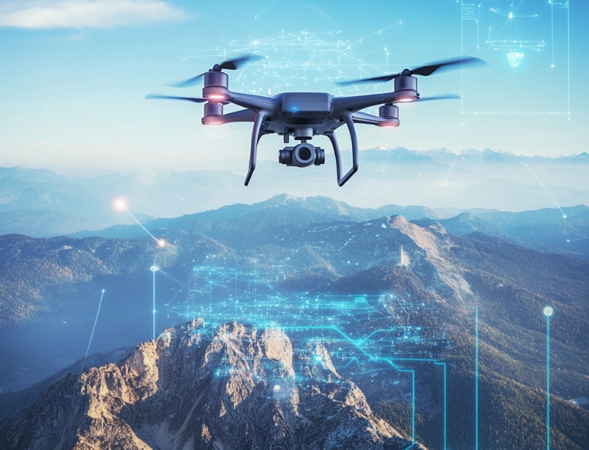
Unmanned Aerial Vehicles (UAVs), commonly known as drones, have become a pivotal technology across industries such as defense, agriculture, logistics, and surveillance. At the core of a drone’s functionality is its communication system, which enables control, data transfer, and situational awareness. Radio Frequency (RF) communication plays a crucial role in ensuring that UAVs can operate effectively in a variety of environments, with high reliability and low latency. Learn more about DRONE-UAV RF COMMUNICATION.
This article delves into the significance of RF communication in Drone-UAV operations, the challenges it presents, the technologies involved, and how future advancements are shaping the communication systems for UAVs.
The Role of RF Communication in Drone-UAV Operations
RF communication is the medium through which most drones communicate with ground control stations (GCS), onboard systems, and other UAVs in a network. It enables the transmission of various types of data, including:
Control Signals: These are essential for operating the UAV, including commands for takeoff, landing, navigation, and flight adjustments.
Telemetry Data: Real-time data on the UAV’s performance, including altitude, speed, battery level, and sensor readings.
Video and Sensor Data: Drones equipped with cameras or other sensors (such as thermal, LiDAR, or multispectral) require high-bandwidth RF communication to send video feeds or sensor data back to the ground station.
Learn more about Optical Delay Line Solutions.
Payload Data: UAVs used for specific tasks like delivery or surveillance may need to transmit payload-related data, such as GPS coordinates, images, or diagnostic information.
Given the variety of data types and the need for real-time communication, a robust and reliable RF communication system is essential for the successful operation of drones in both civilian and military applications.

RF Communication Technologies for Drone-UAVs
The communication requirements of drones are diverse, necessitating different RF communication technologies and frequency bands. These technologies are designed to address challenges such as range, interference, data rate, and power consumption.
1. Frequency Bands
The RF spectrum is divided into several frequency bands, and each is used for different types of communication in UAV systems. The most commonly used frequency bands for drone communications are:
2.4 GHz: This band is one of the most popular for consumer-grade drones. It offers a good balance of range and data transfer speed, although it is prone to interference from other wireless devices (such as Wi-Fi routers and Bluetooth devices).
5.8 GHz: This band is often used for high-definition video transmission in drones, as it offers higher data rates than 2.4 GHz, but with a slightly shorter range. It’s less crowded than 2.4 GHz and typically experiences less interference.
Sub-1 GHz (e.g., 900 MHz): This frequency is used for long-range communications, as lower frequencies tend to travel farther and penetrate obstacles more effectively. It’s ideal for military drones or those used in remote areas.
L, S, and C Bands: These bands are used in military and commercial UAVs for long-range communication, often for surveillance, reconnaissance, and tactical operations. These frequencies have lower susceptibility to interference and are better suited for higher-power transmissions.
2. Modulation Techniques
The RF communication system in drones uses different modulation techniques to efficiently transmit data. Modulation refers to the method of encoding information onto a carrier wave for transmission. Some common modulation techniques used in UAV RF communication include:
Frequency Modulation (FM): Often used in control signals, FM is simple and efficient, providing clear communication with minimal interference.
Amplitude Modulation (AM): Used for video and lower-bandwidth applications, AM transmits a signal whose amplitude is varied to carry the information.
Phase Shift Keying (PSK) and Quadrature Amplitude Modulation (QAM): These more advanced techniques allow for high data transfer rates, making them ideal for transmitting high-definition video or large sensor datasets.
3. Signal Encoding and Error Correction
To ensure that RF communication remains stable and reliable, especially in noisy or crowded environments, drones use advanced signal encoding and error correction methods. These techniques help to mitigate the impact of signal interference, fading, and packet loss. Common methods include:
Forward Error Correction (FEC): This involves adding redundant data to the so that errors can be detected and corrected at the receiver end.
Diversity Reception: Drones may employ multiple antennas or receivers, allowing them to receive signals from different directions and improve the overall reliability of communication.
Spread Spectrum Techniques: Methods like Frequency Hopping Spread Spectrum (FHSS) or Direct Sequence Spread Spectrum (DSSS) spread the signal over a wider bandwidth, making it more resistant to jamming and interference.
4. Long-Range Communication
For long-range missions, RF communication technology needs to go beyond traditional line-of-sight communication. To achieve this, drones can leverage various technologies:
Satellite Communication (SATCOM): When beyond-visual-line-of-sight (BVLOS) operations are required, drones can use satellite links (via L, S, or Ku-band frequencies) to maintain constant communication with the ground station.
Cellular Networks: 4G LTE and 5G networks are increasingly being used for drone communication, especially in urban environments. 5G, in particular, offers ultra-low latency, high-speed data transfer, and extensive coverage.
Mesh Networking: Some UAVs can form mesh networks where each drone communicates with others in the fleet, extending the range of the communication system and providing redundancy.
Challenges in Drone-UAV RF Communication
While RF communication is essential for UAVs, it presents several challenges that need to be addressed to ensure the reliable and secure operation of drones.
1. Interference and Jamming
One of the biggest threats to RF communication in drones is interference from other electronic systems or intentional jamming. Drones, especially in crowded or military environments, must be capable of avoiding interference from various sources, such as:
Other drones operating on the same frequencies.
Wireless communication systems like Wi-Fi or Bluetooth.
Intentional jamming by adversaries in conflict zones or hostile environments.
To mitigate these issues, drones use frequency hopping, spread spectrum techniques, and advanced error-correction algorithms to make communication more resilient.
2. Limited Range and Power Constraints
The effective range of RF communication in drones is limited by factors such as transmitter power, antenna design, and frequency band characteristics. While UAVs with longer ranges can use lower frequencies like 900 MHz or satellite links, they are often limited by battery life and payload capacity.
The trade-off between range and power consumption is an ongoing challenge. Drones must find a balance between maintaining communication and extending their operational flight times.
3. Security Risks
The RF communication channel is vulnerable to security threats, such as signal interception, spoofing, and hacking. Unauthorized access to the communication link could compromise the integrity of the UAV’s operations or allow malicious actors to take control of the drone.
To secure drone communications, encryption methods like AES (Advanced Encryption Standard) and TLS (Transport Layer Security) are employed, ensuring that only authorized parties can decrypt and interpret the transmitted data.
4. Latency and Data Throughput
For applications that require real-time control and feedback, such as autonomous drones or those used in first-responder scenarios, low-latency communication is crucial. High latency could delay mission-critical decisions, especially in dynamic environments like search and rescue operations or military engagements. Additionally, high-data-throughput applications like video streaming require RF systems with robust bandwidth management.
Future Trends in Drone-UAV RF Communication
As UAV technology continues to advance, so will the communication systems that power them. Key trends in the future of drone RF communication include:
5G and Beyond: The rollout of 5G networks is expected to revolutionize drone communications with ultra-low latency, high bandwidth, and greater network density. This will enable more drones to operate simultaneously in urban environments, enhance remote operation, and facilitate advanced applications such as drone swarming and real-time video streaming.
Artificial Intelligence (AI) for Dynamic Communication: AI-powered algorithms can optimize communication links based on environmental conditions, such as avoiding interference, adjusting frequencies, and ensuring maximum data throughput. AI will also play a role in improving autonomous decision-making for UAVs in communication-heavy operations.
Integration with IoT: Drones are increasingly integrated into the Internet of Things (IoT) ecosystem. As a result, drones will not only communicate with ground control but also with other devices and systems in real-time. This opens new possibilities for industrial applications like smart farming, precision delivery, and environmental monitoring.
RF communication is at the heart of every drone’s operation, whether for military, industrial, or commercial use. As UAV technology continues to evolve, so too must the communication systems that support them. RF communication technologies are enabling drones to perform increasingly complex tasks, from surveillance and reconnaissance to logistics and environmental monitoring.
Despite the challenges posed by interference, range limitations, and security risks, advances in RF technology, coupled with innovations like 5G and AI, promise to take UAV communication systems to new heights—fostering more reliable, secure, and efficient operations across a range of industries.
Business Solutions
OTP Verification at Scale with VoIP Smart Support
Effortlessly manage OTP Verification at scale with VoIP Smart Support. Experience secure, reliable, and efficient solutions designed to meet the demands of growing businesses. Simplify authentication and enhance user trust. Discover how VoIP Smart Support can elevate your verification process today!
Published
2 days agoon
May 20, 2025By
Adva
Why Secure Access Needs Smarter Infrastructure
Every second, thousands of users worldwide are receiving one-time passwords to log in, confirm a transaction, or recover access to their accounts. But as digital engagement increases, the flaws in conventional delivery systems are becoming impossible to ignore. Delays, failed messages, and spoofed calls are undermining trust. That’s why scaling an OTP verification service now demands more than basic connectivity—it requires intelligent routing, redundancy, and optimization. Enter VoIP smart technology.
VoIP smart systems are transforming how one-time codes are delivered at scale, offering real-time, programmable, and efficient voice-based alternatives that ensure the code always reaches its destination, regardless of region or network barriers.
What Makes an OTP Verification Service Work?
At its core, an OTP verification service revolves around speed, precision, and trust. Users expect their one-time passwords to arrive immediately—usually within a few seconds—regardless of how or where they’re delivered. This is especially crucial in time-sensitive scenarios like banking logins, e-commerce checkouts, or account recovery.
An OTP system typically includes:
- A token generator to create time-limited codes
- A delivery mechanism (SMS, voice, or app)
- A validation module to check the input from the user
- A logic layer to handle retries, timeouts, and fallbacks
While SMS remains the most popular method, it’s no longer the most reliable—especially across regions with telecom restrictions, low infrastructure coverage, or aggressive message filtering. That’s where smarter alternatives like voice-based delivery come in, backed by intelligent VoIP infrastructure.

The Weak Spots in Traditional OTP Delivery
Many companies stick with SMS OTP because it’s familiar. But familiarity doesn’t guarantee performance. In reality, SMS delivery can be disrupted by:
- Carrier-level A2P (application-to-person) message filtering
- Regulatory hurdles like DND lists and local restrictions
- SIM swapping and spoofing attacks
- Latency due to congested telecom gateways
Worse, there’s minimal visibility when something fails. Delivery receipts are inconsistent, and troubleshooting is often reactive. The result? Lost users, failed logins, and poor brand experience.
By integrating VoIP smart solutions into your OTP verification service, you build resilience into the authentication process, especially in regions with high SMS failure rates.
Enter VoIP Smart: More Than Just Internet Calling
VoIP—short for Voice over Internet Protocol—has long been associated with internet-based calling. But VoIP smart takes it a step further by layering in programmable logic, intelligent routing, and real-time performance optimization.
Instead of simply placing a call, a smart VoIP system evaluates the best route, analyzes delivery quality in real time, and adapts on the fly. It can detect if a number is unreachable and retry through an alternate channel or carrier.
This intelligence is exactly what an enterprise-scale OTP verification service needs. It turns voice OTP delivery from a blunt fallback option into a strategic channel—capable of outperforming SMS in reliability and reach.
How VoIP Smart Transforms OTP Voice Delivery
Voice OTP delivery works by placing an automated call to the user and delivering the code through either a text-to-speech engine or a pre-recorded message. In areas where SMS fails or where regulations limit message delivery, voice calls offer a powerful backup—or even a preferred channel.
VoIP smart platforms enable:
- Dynamic voice scripts that adapt based on user language or location
- Region-aware call routing to minimize latency
- Real-time monitoring of call quality and delivery outcome
- Failover logic that automatically retries through alternate VoIP carriers
In markets like India, Indonesia, and parts of Africa, voice OTP often achieves higher delivery rates than SMS due to fewer telecom constraints. Plus, it’s harder for malicious actors to spoof or intercept voice calls compared to SMS messages.
Speed, Scalability, and Smart Logic
As demand grows, so does the need to handle massive OTP volume—often peaking during events like sales, product launches, or banking hours. A static, linear delivery system won’t hold up. What you need is a system that can auto-scale, adapt, and route intelligently.
VoIP smart APIs are built for this kind of elasticity. They offer features like:
- Load balancing across multiple data centers and carrier routes
- Prioritization of OTP traffic during peak loads
- Pre-configured retry logic based on call outcomes
- Real-time queue adjustments and rate control
This level of control is what makes scaling a global OTP verification service not just possible, but sustainable.
Using VoIP smart to support OTP services ensures your system scales seamlessly under pressure without sacrificing delivery reliability.
Security Boosts from Smarter VoIP Systems
OTP systems are often targeted by fraudsters, who attempt interception, redirection, or social engineering. A poorly configured delivery system can become a vulnerability. Smart VoIP solutions reduce this risk by introducing advanced call security features.
For instance:
- Caller ID masking ensures the OTP appears from a known, verified number
- Token-level encryption ensures only the intended recipient can decrypt the code
- Fraud detection algorithms can block suspicious patterns (like mass retries or number spoofing)
- Call verification logs give audit trails for compliance and dispute resolution
With VoIP OTP, it’s also easier to detect patterns that deviate from user norms—helping to trigger step-up authentication or session blocking when needed.

Hybrid Verification: SMS + Smart VoIP Fallback
The most resilient systems aren’t single-channel—they’re layered. A hybrid strategy blends SMS, smart VoIP, and even in-app push notifications to ensure that no matter what, the user gets their code.
Here’s how it might work:
- Send OTP via SMS.
- If not delivered within 5 seconds, trigger VoIP call with the same code.
- If both fail, offer in-app push or prompt email fallback.
With VoIP smart support, the fallback process becomes invisible and automatic, increasing the overall success rate of code delivery.
Customization and Branding in VoIP OTP Calls
Security doesn’t have to sound robotic. With smart VoIP platforms, you can add a personalized, branded voice to your OTP calls—improving both trust and user experience.
Features include:
- Custom intros (“This is a security call from [Brand Name]”)
- Multilingual voice synthesis
- Dynamic script insertion (e.g., “Your login code for [App] is 482901”)
- Branded caller ID for greater recognition
When users receive consistent, well-branded calls, they’re less likely to drop or ignore the message. That’s critical for first-time logins or sensitive transactions.
Compliance, Costs, and Carrier Interoperability
Operating globally means dealing with vastly different telecom environments. Some carriers restrict certain kinds of traffic. Others charge premium rates or limit the number of messages sent in a window. Staying compliant across this fragmented landscape is no small feat.
VoIP smart platforms are often better positioned to navigate this complexity. They include:
- Automatic compliance with local telephony laws (TRAI, GDPR, TCPA, etc.)
- Per-country call configuration and adaptive rate-limiting
- Cost optimization via dynamic least-cost routing
- Built-in blacklisting, whitelisting, and country restrictions
Smarter Pipes for Safer Passwords
Authentication is only as strong as the channel delivering it. In a world where security threats evolve daily and user expectations are sky-high, real-time delivery of one-time passwords is no longer a nice-to-have—it’s mission-critical.
VoIP smart technology provides the flexibility, performance, and intelligence that modern OTP verification services need to scale globally and perform reliably. It turns static voice delivery into a dynamic, secure, and user-friendly channel, closing the gap between intention and action.
To future-proof your authentication stack, it’s time to add VoIP smart capabilities into your OTP verification service—and ensure your users never wait for a code again.
FAQs
- What is a VoIP smart system?
A VoIP smart system is an advanced Voice over IP platform with intelligent features like programmable routing, real-time call monitoring, dynamic failover, and integration with APIs, making it ideal for time-sensitive services like OTP delivery.
- How does a VoIP smart system improve OTP delivery?
It ensures faster and more reliable OTP delivery by optimizing call routes, adapting to network conditions in real time, and providing fallback options when SMS fails.
- Why is voice-based OTP a good alternative to SMS?
Voice OTPs are less susceptible to message filtering and can reach users even in regions with unreliable SMS delivery or strict telecom regulations.
- Can VoIP smart solutions scale with high OTP demand?
Yes, VoIP smart platforms are built to handle large volumes of OTP traffic with features like load balancing, auto-scaling, and geo-distributed routing.
- Is VoIP OTP delivery secure?
Absolutely. Features like caller ID masking, encrypted tokens, and fraud detection protocols help ensure secure and trustworthy OTP voice calls.
- What happens if both SMS and VoIP OTP fail?
A hybrid OTP system using VoIP smart logic can trigger additional channels like push notifications or email, ensuring multi-layered delivery reliability.
- Can VoIP OTP calls be customized?
Yes. You can use custom voice scripts, brand identification, and language localization to improve user recognition and trust in the verification process.
Business Solutions
From Cloud to Edge: Object Detection Gets an Upgrade
The evolution of AI Object Detection is here, shifting from cloud dependency to powerful edge computing. Experience the benefits of real-time processing, unmatched efficiency, and groundbreaking innovation, as systems become smarter, faster, and more responsive than ever before.
Published
3 days agoon
May 19, 2025By
Marks Strand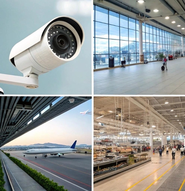
Cameras Are Watching—But Are They Thinking?
It’s one thing to record what’s happening. It’s another to understand it in real time. That’s the leap we’re witnessing as AI object detection shifts from centralized cloud systems to compact, high-performance edge devices.
In airports, on highways, in retail stores, and on factory floors, cameras are everywhere. But flooding the cloud with raw footage for analysis leads to latency, privacy concerns, and bandwidth costs. The solution? Push intelligence to the edge. AI object detection on edge processors is redefining how we approach computer vision: fast, local, efficient, and private.
The Invisible Genius: What Makes an Edge Processor Special
You won’t find edge processors grabbing headlines like GPUs or cloud AI clusters, but their influence is massive. These chips are designed for low-power, high-efficiency computation in constrained environments—often embedded directly into sensors, smart cameras, or microcontrollers.
What makes them special isn’t just performance—it’s purpose. Edge processors are tailored to execute AI inference tasks like object detection using optimized instructions and parallel data pipelines. While a general-purpose CPU might struggle with real-time image processing on a power budget, an edge processor excels.
Some processors, like Google’s Edge TPU or Hailo’s AI accelerator, handle billions of operations per second using mere watts of power. Others include integrated neural processing units (NPUs) or vision-specific architectures that offload tasks from CPUs entirely.

Detection Redefined: Smarter Algorithms Meet Smaller Devices
Running object detection models at the edge means balancing accuracy with efficiency. Large models like Faster R-CNN or YOLOv7 may offer high precision, but they’re too bulky for edge environments. That’s where smaller, faster versions come in.
Optimized models like YOLOv5-Nano, MobileNet SSD, or Tiny YOLO are built to deliver solid performance using fewer resources. They’re lightweight, compressed, and often quantized to 8-bit integer values—trading marginal accuracy for major speed gains.
What’s more impressive is that even with these limitations, many of these models still achieve real-time inference on low-cost edge processors. This democratizes access to AI for use cases where deploying a full GPU server would be impractical or too expensive.
The Edge Advantage: Why the Cloud Can’t Compete Here
There’s a growing realization that not everything belongs in the cloud. For AI object detection tasks, especially those requiring real-time decision-making, the edge is often a better fit.
First, there’s latency. When milliseconds count—as in autonomous vehicles or security systems—sending data to the cloud, waiting for analysis, and receiving a response just isn’t fast enough. Edge processors eliminate that round-trip.
Second, there’s privacy. Streaming raw video from sensitive locations raises obvious concerns. Keeping data on-device not only secures it but also reduces the risk of breaches and compliance violations.
Lastly, bandwidth costs matter. Continuous uploads to the cloud can eat up data plans and network capacity. Local inference means only relevant insights—like alerts or metadata—need to be transmitted.
Small But Mighty: How These Chips Handle Complex AI Tasks
Edge processors may be small, but they’re far from underpowered. Many are purpose-built to handle tensor operations, convolutional filters, and matrix multiplication—the building blocks of neural networks.
Some edge devices use a hybrid architecture combining CPU, GPU, and NPU elements to allocate tasks efficiently. Others include dedicated accelerators for vision workloads, enabling high frame-per-second processing with minimal energy draw.
For instance, devices used in drones or smart security cameras might run object detection at 30 to 60 FPS while using less than 5 watts of power. This makes them ideal for battery-powered and thermally constrained environments.
The real beauty lies in the scalability. From tiny chips embedded in IoT devices to more powerful edge servers at the edge of enterprise networks, the architecture can be tuned to meet the needs of nearly any object detection task.
Edge vs Cloud: It’s Not a War—It’s a Collaboration
While edge computing is gaining momentum, it’s not about replacing the cloud—it’s about distributing intelligence intelligently. The two should complement each other.
Edge processors handle inference and decision-making locally, while the cloud is ideal for long-term storage, training models, aggregating data across devices, and performing analytics. In many systems, detected objects and events are logged locally and then pushed to the cloud during low-traffic periods for archiving or deeper analysis.
This hybrid model improves efficiency and balances cost with capability. And with the advent of 5G and Multi-access Edge Computing (MEC), the boundary between edge and cloud is becoming increasingly flexible.
Software Eats Silicon: Frameworks Powering Edge AI
The best hardware still needs great software. A variety of frameworks exist to bring AI models to edge processors efficiently.
TensorFlow Lite, ONNX Runtime, and PyTorch Mobile allow developers to convert large AI models into edge-ready formats. Intel’s OpenVINO and NVIDIA’s TensorRT take things further by optimizing for specific chipsets. These tools also support quantization, pruning, and layer fusion—techniques that shrink models while preserving performance.
On the deployment side, containerization platforms like Docker and Kubernetes (yes, even on edge devices) allow developers to push updates, scale deployments, and maintain consistent environments across devices.
And because edge devices are often deployed in remote or inaccessible locations, over-the-air (OTA) update support is critical to keep AI models and firmware up to date.

What Slows It Down: Bottlenecks in Edge-Based Detection
Despite the advantages, edge deployments come with limitations. Processing power is finite. Memory is limited. Thermal headroom is tight. Pushing a model beyond what the hardware can handle results in frame drops, delayed inference, or complete system crashes.
A common issue is trying to run large models at high resolution. Downsampling inputs, using frame skipping, or focusing on regions of interest are some ways to optimize. Developers also use asynchronous inference—decoupling detection from camera input speed—to prevent bottlenecks.
Other challenges include managing multiple sensor streams, integrating audio or IMU data, and ensuring reliable performance in fluctuating environmental conditions.
Security Starts at the Silicon
With data and inference happening on-device, edge processors must also take on the role of digital sentinels. Secure boot ensures the device only runs signed firmware. Hardware-based key storage protects sensitive encryption credentials.
In environments like smart cities or healthcare, it’s critical that AI devices aren’t just intelligent—they must be trustworthy. Some edge platforms now include anomaly detection at the system level to flag unexpected behavior or unauthorized access attempts.
By pushing intelligence to the edge, systems also become more resilient. Even if a central server goes down or a network link fails, the edge device can continue operating autonomously.
What’s Next: The Future of AI Object Detection on the Edge
The edge is evolving fast. New chip designs are integrating AI cores directly into image sensors, enabling pre-processing and classification at the pixel level. This will dramatically speed up detection while reducing data flow.
We’re also seeing multimodal fusion—where AI combines visual data with sound, location, or environmental inputs. Edge processors will need to handle these blended streams in real time, opening the door to richer insights.
Another exciting development is edge federated learning. Instead of pushing data to the cloud, models are trained locally across devices and aggregated later, preserving privacy while improving performance.
And as edge AI standards mature, expect plug-and-play compatibility, AI app stores, and no-code deployment platforms to emerge—making it easier than ever to deploy and scale AI object detection at the edge.
AI object detection has moved beyond the server rack. With edge processors now capable of high-speed, low-power inference, the future of computer vision is hyperlocal, scalable, and responsive. From smart surveillance and autonomous vehicles to factory automation and retail analytics, the edge is where real-time intelligence happens.
By deploying purpose-built hardware and optimized AI models directly at the source of data, organizations gain speed, privacy, efficiency—and most importantly—control. As the gap between sensing and understanding continues to shrink, one thing is clear: object detection just got a major upgrade, and it’s happening at the edge.
FAQs: Edge Processors and AI Object Detection
- What is an edge processor in AI systems?
An edge processor is a specialized chip designed to run AI models locally on devices such as cameras, sensors, or gateways—without needing to send data to the cloud for processing.
- How does AI object detection work on the edge?
AI object detection on the edge involves running trained models directly on local hardware to identify and classify objects in images or video in real time, without relying on internet connectivity.
- Why is edge processing better than cloud for object detection?
Edge processing reduces latency, enhances privacy by keeping data local, lowers bandwidth costs, and allows for real-time decision-making—crucial for time-sensitive applications like surveillance or robotics.
- What are the benefits of using AI object detection at the edge?
Key benefits include faster response times, improved data privacy, offline functionality, and reduced reliance on network infrastructure or cloud services.
- What types of models are used for edge-based object detection?
Lightweight and optimized models such as YOLOv5-Nano, SSD-Lite, and MobileNet are commonly used for edge deployments due to their small size and fast inference capabilities.
- What hardware supports AI object detection at the edge?
Common hardware includes edge processors with NPUs (Neural Processing Units), AI accelerators like Google Edge TPU or NVIDIA Jetson, and embedded SoCs designed for AI inference.
- Are there any challenges in running object detection on edge processors?
Yes, limitations in processing power, memory, and thermal constraints can affect performance. Model optimization and efficient coding are essential to overcome these challenges.
- How do edge processors handle updates or model changes?
Many edge platforms support over-the-air (OTA) updates, allowing AI models and system firmware to be updated remotely without physical access to the device.
- What role does security play in edge-based AI systems?
Edge devices require robust security features like secure boot, encrypted storage, and device authentication to prevent tampering, especially when handling sensitive visual data.

Drone-UAV RF Communication: The Backbone of Modern Aerial Operations

OTP Verification at Scale with VoIP Smart Support

From Cloud to Edge: Object Detection Gets an Upgrade
Trending
-
Marketing & Analytics2 years ago
A Complete Guide To HubSpot’s New B2B Marketing, Sales Hub, and Prospecting Tool
-
3D Technology2 years ago
3D Scanner Technology for Android Phones: Unleashing New Possibilities
-
Marketing & Analytics2 years ago
How SMS Services And Software For Bulk SMS Sending Can Help Your Business Grow
-
3D Technology2 years ago
Mobile 3D Scanners: Revolutionizing 3D Scanning Technology
-
3D Technology3 years ago
3D scanning technologies and scanning process
-
Business Solutions1 year ago
Understanding A2P Messaging and the Bulk SMS Business Landscape
-

 Business Solutions1 year ago
The Power of Smarts SMS and Single Platform Chat Messaging
-

 Automotive2 years ago
DSRC vs. CV2X: A Comprehensive Comparison of V2X Communication Technologies


