


3D Technology
Aerial Survey and Mapping
Aerial mapping and surveying has been around for long. It’s useful across industries, including infrastructure development, agriculture, and forestry. Technological advances such as the development of better sensors and the integration of AI-powered analysis have resulted in even better aerial survey results. Three-dimensional representations of territory and infrastructure can be acquired. Point clouds can be used for mathematical calculations and analysis.
Currently, a wide range of sensors can be used for aerial photography, resulting in richer results. For example, with the use of near-infrared Imagery coupled with RGB sensors, vegetation can be reliably analyzed. Such a multi-sensory approach enables the use of the Normalized Difference Vegetation Index for such use cases as assessing the health of crops.
An aerial survey camera can also be equipped with a thermal sensor, enabling applications such as the assessment of roofs to direct maintenance efforts.
Perhaps the most useful development in aerial survey and mapping is the development of high-quality sensors. Currently, there are medium format cameras which have resolutions as high as 100MP. With a large format aerial solution, images with a resolution as high as 280MP can be captured.
The use of drones in aerial mapping and survey is becoming a standard. For example, in aerial 3D mapping of sections in cities, drones have proven invaluable. Some drones have payloads consisting of 50-MP cameras. Such high-quality sensors, coupled with the fact that drones can fly much lower than helicopters and planes, ensures that the images captured by drones are of sufficiently high quality to allow advanced analysis, such as that powered by machine learning and artificial intelligence algorithms.
Forms of Data Acquired Through Aerial Surveys
Depending on the purpose of aerial survey, the resulting data can be represented in a variety of formats, including contour lines, digital surface models, digital terrain models, point clouds, 3D maps, and orthophotos.
Orthophotos
These are simply two-dimensional representations of the terrain under survey. They are usually geo-referenced.
Typically, multiple aerial photos are taken and combined to provide highly-accurate two-dimensional information. Such photos are calibrated to topography standards. They can be used for measurement and planning.
Digital Surface Models
Such models are used to represent the terrain of a territory and are usually color coded. The color coding is used to indicate altitudes, with one end of the RGB spectrum representing the lowest points and the other end representing the highest.
They are used to make advanced calculations, such as cut and fill, and are useful for planning.
Digital surface models can either be two-dimensional or three-dimensional, depending on the file format used. They are usually used to represent everything on a terrain, from buildings to trees.
Digital terrain modes, on the other hand, usually represent only the raw ground data about a terrain, that is, the altitude values of different points.
Contour Lines
A contour line file consists of the three-dimensional representation of a terrain expressed through vectorized lines that are made at regular intervals. Such files are usually generated from digital surface and terrain models.
Point Clouds and 3D Models
A point cloud is a representation of a terrain using a multitude of points. Each point has three-dimensional data.
Point clouds are instrumental in the calculation of volumes, distances, and areas, as well as the determination of percentage of slope. Point clouds also offer an accurate depiction of terrains since they can be colorized.
3D models are three-dimensional representations of terrain. Unlike point clouds, 3D models are continuous and are perfect for visualization rather than calculations.
Index Maps
These are representations of terrains according to indices such as the Normalized Difference Vegetation Index. Index maps come in handy in the analysis of vegetation.
For example, in agriculture, index maps can give insight into the health of crops. Plants reflect various types of light differently, for example depending on their chlorophyll content. The analysis of an index map can help a farmer identify crops which don’t have enough chlorophyll and which may be diseased.
Aerial 3D Mapping
With an aerial survey camera, it’s easy to acquire a 3D map of territory. Aerial 3D mapping can be done through manned aircraft such as helicopters and planes or through unmanned aerial vehicles.
Data can be acquired through photogrammetry, where multiple photos are taken and later stitched together using special software, or through Light Detection and Ranging (LiDAR) sensors.
The use of a large format aerial solution on manned planes is useful when capturing data on large tracts of territory. With the high-resolution that comes with large format solutions, the manned plane can fly high and still capture high-quality images.
To use LiDAR, a drone equipped with a LiDAR sensor is all that’s required.
Drones and Agriculture
Drones are becoming crucial in agriculture, especially now that amid an increasing world population, producing enough food has become a challenge. They are being used directly in food production. For example, they are an important tool in precision agriculture.
In addition, drones have become instrumental in other areas related to agriculture. For example, phenotyping with UAVs or drones is growing in popularity. Phenotyping is a field of science that involves the study of the effects of genotype and the environment on crops. It aims to promote the development of desirable characteristics in crops.
The use of drones in areas such as phenotyping comes with an array of advantages. For starters, it’s affordable, both in terms of costs and the effort made. The use of manned aircraft is subject to more stringent regulations than the use of drones. Drones can also cover relatively large areas, which makes them more suitable than traditional methods of survey such as ground teams.
By aiding precision agriculture, drones are revolutionizing the production of food. Precision agriculture promotes the efficient use of resources, including fertilizer and water. To achieve it, data is crucial and drones come in handy in the data collection about farms.
With drones, index maps of farms can be acquired and used to determine which parts of a farm need watering. With this information, rather than watering the whole farm blindly, water can be used more judiciously.
At the same time, the information acquired through drones can be used to analyze the history of produce to determine infertile areas which most need fertilizer.

3D Technology
Automotive PCBs: Engineering Reliability for the Era of Autonomous and Electric Vehicles

The modern automobile is no longer simply a mechanical machine. Today’s vehicles — whether a conventional combustion engine car, a battery electric vehicle (BEV), or a fully autonomous system — are deeply sophisticated electronics platforms. Every function, from the engine management system and power steering to the infotainment screen and lidar sensor array, depends on printed circuit boards engineered to perform reliably across extreme temperature ranges, severe vibration, and decades of continuous operation.
Automotive PCBs are among the most demanding products in the electronics manufacturing industry. Failure is not an option: a board that malfunctions in an automotive safety system can have life-altering consequences. This article explores the technology, standards, and applications that define automotive PCBs — and explains why pcb-technologies is a trusted supplier to OEMs and their Electronic Manufacturing Services (EMS) providers worldwide.
Why Automotive PCBs Are Different
Automotive electronics must operate across temperature ranges from -40°C to 85°C or beyond, withstand continuous vibration and mechanical shock, resist moisture and chemical exposure, and maintain full performance for 15+ years of vehicle lifetime. Standard commercial PCBs are not designed for these demands.
The transition to electric and autonomous vehicles has intensified these requirements. New automotive PCB challenges include:
- Power electronics for EV drivetrains: High-current boards managing hundreds of amperes and hundreds of volts for motor inverters and charging systems
- AI processors for autonomous driving: Boards supporting AI accelerators (GPUs, TPUs) with Ball Grid Array packages requiring fine lines, micro-vias, and ultra-low-loss materials for data rates exceeding 25 Gbps
- Lidar and radar modules: High-frequency RF boards requiring specialized PTFE or ceramic-based laminates to maintain signal integrity at millimeter-wave frequencies
- ADAS sensor fusion: Multiple sensor types (radar, lidar, cameras, ultrasonic) integrated through high-density PCB interconnects
- In-cabin electronics: Touchscreens, heads-up displays, driver monitoring systems — all requiring compact, reliable PCBs
Types of PCBs Used in Automotive Applications
pcb-technologies supplies multiple PCB types tailored to the specific demands of automotive electronics:
HDI PCBs (High-Density Interconnect)
HDI PCBs are ideal for automotive control technology, with the ability to pack more functionality into a smaller, lighter footprint. In an industry where size and weight are critical for fuel efficiency and EV range, HDI technology uses micro-vias and fine lines to enable complex, multi-layered designs that would be impossible on conventional boards. pcb-technologies produces HDI boards using the Excellon Cobra Hybrid Laser system and X-VIA technology for precise, void-free via structures.
Rigid-Flex PCBs
Combining the durability of a rigid board with the flexibility of a flex circuit, rigid-flex PCBs are perfect for automotive applications that require a design fitting into tight or irregularly shaped spaces — such as steering column electronics, dashboard assemblies, and camera modules in door mirrors. Rigid-flex eliminates the need for bulky connectors and wire harnesses, reducing both weight and failure points.
RF Boards (Radio Frequency)
Modern vehicles depend on a growing number of RF systems: GPS, V2X (vehicle-to-everything) communications, LTE/5G telematics, radar-based ADAS systems, and keyless entry. RF boards require specialized materials like PTFE or ceramic-based laminates to maintain signal integrity and minimize loss at high frequencies. pcb-technologies has extensive expertise in RF board design and fabrication.
Thermal Management PCBs
Automotive electronics impose significant thermal loads, particularly in power electronics for EVs and high-performance engine control units. pcb-technologies combines materials science, mechanical engineering, and PCB manufacturing technology to effectively dissipate heat. Solutions include embedded copper coins, thermal vias, metal-core boards, and specialized thermally conductive laminates.
Automotive Quality Standards: IATF 16949 and Beyond
The automotive industry operates under some of the strictest quality management requirements in any sector. The key standard is IATF 16949, which defines quality management system requirements specifically for the design, development, production, installation, and service of automotive-related products.
pcb-technologies is certified to IATF 16949, along with a comprehensive suite of additional certifications relevant to automotive customers:
- IATF 16949 — Automotive quality management system
- ISO 9001 — General quality management
- ISO 14001 — Environmental management
- NADCAP — Defense and aerospace process accreditation (for defense-grade automotive programs)
- AS9100 — Aerospace quality management (relevant for autonomous vehicle programs with aerospace-grade requirements)
- RoHS Lead-Free compliance — Fully compliant with automotive RoHS requirements
- IPC-A-610 and J-STD-001 — Assembly standards for all PCBA
pcb-technologies’ Automotive PCB Capabilities
With over 40 years of experience in high-reliability PCB manufacturing, pcb-technologies has built a well-earned reputation in the automotive sector. Key capabilities include:
- Full design services: From initial schematic through DfM, DfT, DfP, DfC, and DfA analysis — optimized for automotive quality and cost targets
- Advanced materials: Including Rogers laminates, PTFE, polyimide, and metal-core for specific automotive performance requirements
- High-current PCBs: Supporting relay and fuse boxes, DC/DC converters, inverters for EV systems, and power/signal integration on one board
- PCBA with advanced packaging: Including Package-on-Package (POP), Micro BGAs, and IC packaging services through the iNPACK division
- Comprehensive testing: ICT, AOI, functionality testing, and vibration testing (S452 Electrodynamic Shaker) — critical for automotive reliability validation
- NPI (New Product Introduction): Fast-tracked NPI services supporting rapid development cycles typical in automotive Tier 1 and OEM programs
The Road Ahead: Automotive Electronics Trends
The automotive PCB market is in the midst of a fundamental transformation, driven by electrification and autonomy:
- Software-defined vehicles: Central computing architectures replacing distributed ECUs, requiring fewer but more powerful, high-density PCBs
- V2X (Vehicle-to-Everything): PCBs supporting 5G NR and DSRC communication modules for cooperative driving
- Integrated AI at the edge: Boards with AI accelerators running machine learning models for real-time visual quality control and autonomous decision-making
- Wearable and in-cabin electronics: Flexible and rigid-flex PCBs enabling new form factors for driver and passenger interfaces
- Battery Management Systems (BMS): High-reliability, high-current boards for EV battery pack management
pcb-technologies is positioned to serve all these emerging requirements, with its iNPACK miniaturization platform and comprehensive design-to-production capability ready for the automotive industry’s next decade.
Learn more about pcb-technologies’ automotive PCB solutions at automotive industry page.
Explore the iNPACK division for advanced packaging in automotive applications at pcb-technologies iNPACK.
Return to the pcb-technologies homepage at pcb-technologies.com.
Frequently Asked Questions
Q: What certifications does pcb-technologies hold for automotive PCBs?
A: pcb-technologies is certified to IATF 16949 (automotive), ISO 9001, ISO 14001, NADCAP, AS9100, and RoHS. All assembly is performed by IPC-A-610 and J-STD-001 certified experts.
Q: What types of PCBs are used in electric vehicles?
A: EV applications use HDI PCBs (for ADAS and control electronics), RF boards (for telematics and radar), thermal management PCBs (for power electronics and battery management), rigid-flex PCBs (for compact form factors), and high-current boards for inverters, converters, and battery management systems.
Q: Why is thermal management critical for automotive PCBs?
A: Automotive electronics generate significant heat, especially in EV power electronics and AI processors. Boards that cannot dissipate heat reliably will fail prematurely — a safety-critical issue. Thermal management solutions include embedded copper coins, thermal vias, metal-core boards, and specialized laminates.
Q: What is IATF 16949 and why does it matter?
A: IATF 16949 is the international automotive quality management standard. It covers design, development, production, installation, and service of automotive-related products. Automotive OEMs and Tier 1 suppliers typically require their PCB manufacturers to be IATF 16949 certified.
Q: Can pcb-technologies produce automotive PCB prototypes as well as production volumes?
A: Yes. pcb-technologies supports the full product lifecycle — from NPI prototype through low, mid, and high volume production — all with the same quality standards and certifications.
3D Technology
How Multispectral Cameras Advance Book Scanning
Multispectral cameras are revolutionizing book scanning by uncovering hidden details, preserving fragile texts, and advancing historical document analysis. These advanced tools capture layers of information invisible to the naked eye, ensuring priceless works are preserved for future generations while providing new insights into our written past.
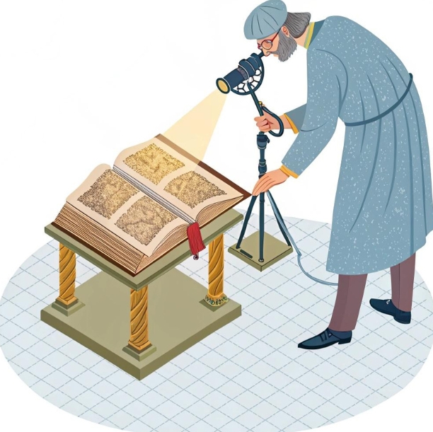
Imagine revealing hidden texts on a centuries-old manuscript without ever touching the ink. That’s the power of modern imaging technology. Today, book scanning has evolved far beyond simple digital copying—thanks in part to the transformative capabilities of the multispectral camera. These advanced imaging tools are helping archivists, conservators, and researchers uncover layers of information once thought lost to time.
From preserving fragile texts to recovering writings that are invisible to the naked eye, multispectral imaging is revolutionizing the way we digitize, understand, and conserve books.
What Makes Book Scanning So Challenging?
At first glance, scanning a book may seem straightforward: open, place on a scanner, capture. But working with historical or rare volumes is anything but simple. The materials are often fragile, with binding that cannot be fully opened without damage. Inks may have faded over centuries, and pages are sometimes warped, stained, or chemically altered by age and environment.
Standard RGB scanners capture what the human eye sees—red, green, and blue light. While this is fine for a crisp, modern paperback, it fails to capture hidden or degraded content that has faded into the paper over time. Texts erased by water damage or overwritten by later scribes often become unreadable under visible light.
The need for non-invasive, high-fidelity imaging that respects the integrity of these delicate works has pushed researchers toward more sophisticated solutions.
How Multispectral Cameras Work
Multispectral imaging captures data at specific wavelengths across the electromagnetic spectrum, including ultraviolet, visible, and infrared light. Unlike traditional photography, which only captures light as we perceive it, a multispectral camera detects subtle variations in how different materials absorb and reflect light beyond the visible range.
Each layer or pigment in a manuscript may react differently under specific wavelengths. For example, iron gall ink absorbs infrared light, which can make faded handwriting reappear. Organic pigments may fluoresce under UV light, revealing marginalia or annotations invisible in daylight.
This multi-layered approach allows digital imaging specialists to isolate and enhance features hidden beneath the surface—sometimes quite literally.
The Hidden Value of Multispectral Imaging in Book Scanning
One of the most powerful applications of multispectral imaging is text recovery. Historical documents often suffer from fading, overpainting, or even intentional erasure. A multispectral camera can bring back those lost words. By adjusting wavelengths and analyzing spectral differences, researchers can virtually peel back layers of ink or paint.
Multispectral cameras have been used to uncover palimpsests—manuscripts where the original text was scraped off and overwritten. This was common practice in the medieval period when parchment was scarce. Imaging under infrared or ultraviolet wavelengths can isolate the original ink from the newer text, allowing scholars to recover works thought lost.
This technology also plays a role in identifying materials. Certain inks or pigments fluoresce or absorb light differently based on their chemical composition. This can help determine the age and origin of a text, supporting authentication and conservation strategies.
In the realm of illuminated manuscripts and rare books, multispectral imaging reveals artistic techniques and editorial changes. What once lay hidden beneath centuries of aging and retouching becomes visible again, enriching the understanding of the object’s history.
Applications in Restoration and Digital Preservation
Digitization is not merely about creating a digital backup. For cultural institutions, it’s about preserving the experience, the texture, and the historical context of a book. Multispectral imaging helps achieve that goal.
With a multispectral camera, archivists can produce a digital twin of a rare book, capturing more than just the ink on the page. The system can identify discoloration, mold, and water damage—data that informs conservation plans. In some cases, multispectral imaging has revealed insect trails, binding repairs, or even notes from bookbinders left on the inner spine.
In academic research, this depth of imaging allows scholars remote access to detailed replicas, reducing the need to physically handle delicate materials. This not only preserves the book but also democratizes access for institutions without direct access to such collections.
Multispectral vs. Hyperspectral Imaging: What’s the Difference?
The terms multispectral and hyperspectral are often used interchangeably, but there are key differences. Multispectral imaging captures data across a limited number of discrete bands—typically anywhere from 3 to 15. Hyperspectral imaging, by contrast, collects data from hundreds of contiguous spectral bands.
For book scanning purposes, multispectral systems strike a balance between performance and practicality. They are generally more compact, faster, and easier to operate, while still providing the necessary level of spectral detail to uncover hidden or faded content.
Hyperspectral systems may offer finer spectral resolution, but they require more data storage, longer processing times, and more complex calibration. In many archival and preservation settings, the benefits of multispectral imaging outweigh the added complexity of hyperspectral setups.
Choosing the Right Equipment for Cultural Heritage Work
Not all imaging systems are created equal. When selecting a camera system for book scanning, institutions must consider resolution, wavelength range, sensitivity, and software capabilities.
A high-quality multispectral camera designed for cultural heritage work should allow tunable illumination across UV, visible, and IR bands. The camera sensor must be sensitive enough to capture subtle contrasts, and the lens system should minimize distortion, particularly at the edges of curved pages.
Equally important is the software. Advanced processing tools allow operators to isolate channels, adjust contrast, and combine spectral layers to produce meaningful images. The software must also support metadata standards required for digital archiving, ensuring long-term usability and searchability of the files.
Portability and non-contact operation are often critical in environments like libraries or monasteries where the subject cannot be moved or unbound. Systems that support adjustable lighting angles and image stacking also help reduce glare and page curvature.
Challenges and Best Practices in Multispectral Book Scanning
As powerful as multispectral technology is, it’s not without its challenges. Calibration is essential—ambient light, temperature shifts, or misaligned optics can skew results. Most workflows require regular calibration using reference targets to ensure color fidelity and wavelength accuracy.
Lighting must be controlled precisely. Too much UV exposure, for example, can degrade delicate pages. Many systems use pulsed or narrow-band LED lighting to minimize heat and light damage while maintaining illumination consistency.
Stabilizing the book is another critical factor. Scanning should be done with minimal physical stress. Cradles, vacuum tables, or V-shaped book supports are commonly used to hold books gently in place without opening them beyond their structural limits.
Metadata is a final consideration. Multispectral scans produce large volumes of data—often hundreds of megabytes per page. Organizing, labeling, and backing up these files in accordance with international standards is essential for long-term accessibility.
Illuminating the Invisible, One Page at a Time
Multispectral imaging is opening doors once thought permanently closed. Faded poetry, erased philosophies, and hidden marginalia are reemerging into view—not through excavation, but through light.
As libraries, museums, and archives race to digitize and preserve the world’s most precious documents, the value of high-resolution, wavelength-targeted imaging becomes clear. A multispectral camera doesn’t just scan a book—it tells its full story, one invisible layer at a time.
Institutions that embrace these technologies will lead the way in conservation, access, and scholarship. For the historians, linguists, and preservationists of tomorrow, these scans will be the key to unlocking the past.
Reveal centuries of history with modern book scanning systems powered by multispectral imaging.
FAQs on Multispectral Imaging and Book Scanning
- What is a multispectral camera and how is it used in book scanning?
A multispectral camera captures images across different light wavelengths—such as ultraviolet, visible, and infrared—to reveal hidden or faded details in books that aren’t visible to the naked eye. - How does multispectral imaging differ from traditional scanning?
Traditional scanning captures visible light (RGB), while multispectral imaging collects data from specific non-visible wavelengths, allowing it to uncover erased text, watermarks, or pigment changes in old manuscripts. - Why is multispectral imaging important for cultural heritage preservation?
It enables archivists and researchers to digitally recover and preserve texts, annotations, and materials that are at risk of being lost due to aging, damage, or previous erasure. - Can multispectral cameras damage fragile books?
No, they are non-contact and use controlled lighting. Many systems are specifically designed to minimize exposure to UV or heat, making them safe for delicate or ancient materials. - What types of materials benefit most from multispectral book scanning?
Rare manuscripts, parchment texts, palimpsests, and any documents with faded inks or hidden writings benefit greatly from multispectral imaging. - How does multispectral imaging help in text recovery?
It isolates ink and pigment types by analyzing how they react to different wavelengths, allowing hidden, overwritten, or faded text to become readable again. - Is multispectral imaging better than hyperspectral for scanning books?
Multispectral imaging offers a good balance of performance and practicality. It’s typically faster and more manageable for libraries, while hyperspectral provides more data but with added complexity. - What equipment is needed to perform multispectral book scanning?
A multispectral camera, tunable lighting (UV, VIS, IR), stable book cradles, calibration targets, and specialized image processing software are essential components. - Can libraries and archives afford multispectral imaging systems?
While advanced systems can be costly, there are compact and modular solutions becoming more affordable, especially with grant funding or institutional partnerships.
3D Technology
3D Scanner Technology for Android Phones: Unleashing New Possibilities
From capturing family moments to creating stunning architecture designs, the possibilities of 3D scanning technology are limitless. And now, with advanced 3D scanner technology available for Android phones, we’re about to enter a new era of creativity and innovation. In this blog post, we’ll take a closer look at how 3D scanner technology is changing the game for Android users and unlocking exciting new possibilities that were once out of reach. So fasten your seatbelts and get ready to explore the world of 3D scanning on your smartphone!
The rapid advancement of technology has brought us to an era where 3D scanning is no longer confined to specialized equipment. With the advent of 3D scanner technology for Android phones, individuals now have the power to capture three-dimensional objects and environments using their mobile devices. In this article, we will delve into the capabilities and potential applications of this emerging technology, fueled by the integration of 3D structured light technology into the compact form of a mobile phone 3D scanner.
Understanding 3D Scanner Technology for Android Phones
The integration of 3D scanning capabilities into Android phones has been made possible by leveraging the device’s built-in cameras, sensors, and processing power. This development enables users to capture 3D data with ease, transforming real-world objects into digital representations that can be further manipulated or shared.
The Rise of 3D Structured Light Technology
One of the key technologies behind mobile phone 3D scanners is 3D structured light technology. This method involves projecting a pattern of light onto the subject and using the phone’s camera to capture the deformation of the pattern caused by the object’s shape. By analyzing these deformations, the phone’s software reconstructs a detailed 3D model of the subject.

Applications of Mobile Phone 3D Scanners
The integration of 3D scanner technology into Android phones opens up a myriad of possibilities. Here are a few potential applications:
3D Printing and Design: Mobile phone 3D scanners allow users to easily capture physical objects and convert them into digital models that can be modified or replicated using 3D printing technology. This capability empowers designers, hobbyists, and makers to bring their ideas to life with precision and ease.
Virtual and Augmented Reality: With a mobile phone 3D scanner, users can capture their surroundings and create 3D models for virtual or augmented reality experiences. This technology has the potential to revolutionize gaming, architectural visualization, interior design, and other immersive applications.
Documentation and Preservation: Mobile phone 3D scanners provide a convenient way to capture and preserve the details of cultural artifacts, historical sites, or archaeological findings. This technology enables researchers and enthusiasts to create accurate 3D models for documentation, analysis, and virtual exhibitions.
Q&A Section:
How accurate are 3D scans captured using mobile phone scanners?
The accuracy of 3D scans captured by mobile phone scanners can vary depending on factors such as lighting conditions, the quality of the phone’s camera and sensors, and the scanning technique employed. While mobile phone scanners may not match the precision of professional-grade 3D scanners, they still offer impressive results for a wide range of applications, especially for hobbyists and casual users.
Can mobile phone 3D scanners handle large-scale objects or environments?
Mobile phone 3D scanners are more suitable for capturing small to medium-sized objects due to the limitations of their hardware and scanning range. Attempting to scan large-scale objects or environments might result in reduced accuracy or incomplete data capture. For such applications, dedicated 3D scanners with larger scanning ranges would be more appropriate.
What software is required to process and edit 3D scans captured by mobile phone scanners?
Various mobile applications are available for processing and editing 3D scans captured by mobile phone scanners. These apps allow users to align, clean, and refine the captured data, as well as export it in various formats compatible with 3D modeling and printing software.
The integration of 3D scanner technology into Android phones has opened up new creative and practical possibilities for users. With the ability to capture and manipulate 3D models on their mobile devices, individuals now have a powerful tool at their fingertips. From 3D printing enthusiasts bringing their designs to life to architects visualizing their creations in augmented reality, the accessibility of mobile phone 3D scanners is democratizing the world of three-dimensional scanning.
Moreover, the convenience and portability of mobile phone 3D scanners make them ideal for on-the-go scanning needs. Whether you want to capture the intricate details of a unique artifact or document a space for virtual walkthroughs, these scanners provide a user-friendly and versatile solution.
As technology continues to evolve, we can expect mobile phone 3D scanners to become even more sophisticated and capable. The integration of advanced sensors, improved camera technologies, and enhanced processing power will likely lead to higher accuracy and faster scanning speeds. This will further expand the range of applications for mobile phone 3D scanners and empower users to explore new creative horizons.
Additional Resources:

RF Converters: How RF-to-Optical Converters Work in Modern RF Systems

Automotive PCBs: Engineering Reliability for the Era of Autonomous and Electric Vehicles

Microsoft Power Platform Security: The Risks You Cannot See and How to Address Them

-
3D Technology3 years ago
3D Scanner Technology for Android Phones: Unleashing New Possibilities
-
Business Solutions2 years ago
Understanding A2P Messaging and the Bulk SMS Business Landscape
-

 Business Solutions2 years ago
The Power of Smarts SMS and Single Platform Chat Messaging
-

 Automotive3 years ago
DSRC vs. CV2X: A Comprehensive Comparison of V2X Communication Technologies
-
Tech3 years ago
On Using Generative AI to Create Future-Facing Videos
-

 Business Solutions2 years ago
Exploring OTP Smart Features in Smart Messaging Services
-

 Business Solutions2 years ago
Live Video Broadcasting with Bonded Transmission Technology
-

 Business Solutions10 months ago
The Future of Healthcare SMS and RCS Messaging